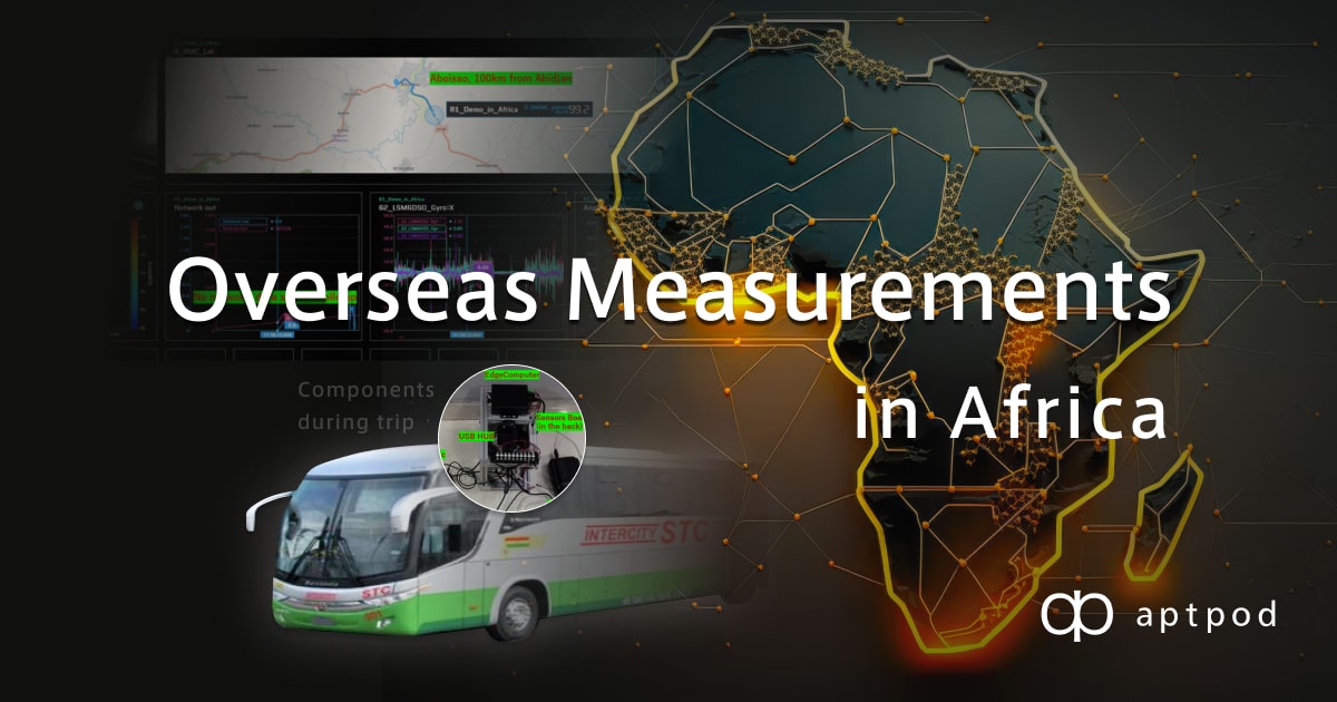
Hi All, I’m Hirano working as a Hardware engineer in the Development Division. At Aptpod, we have some clients who are using our products for measurements abroad. And sometimes they face different kinds of problems and taking measurements abroad seems to be a bit complicated. This year, I planned to take a long 28-day vacation to visit my family in Ivory Coast and Benin. So, I wonder how it would be to use one of our products during my trip to Africa and share my experience with my colleagues and (why not) with you too reader here...
Preparation
System Construction
Data I would like to Measure and Choice of the edge computer
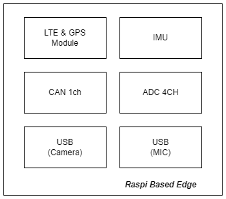
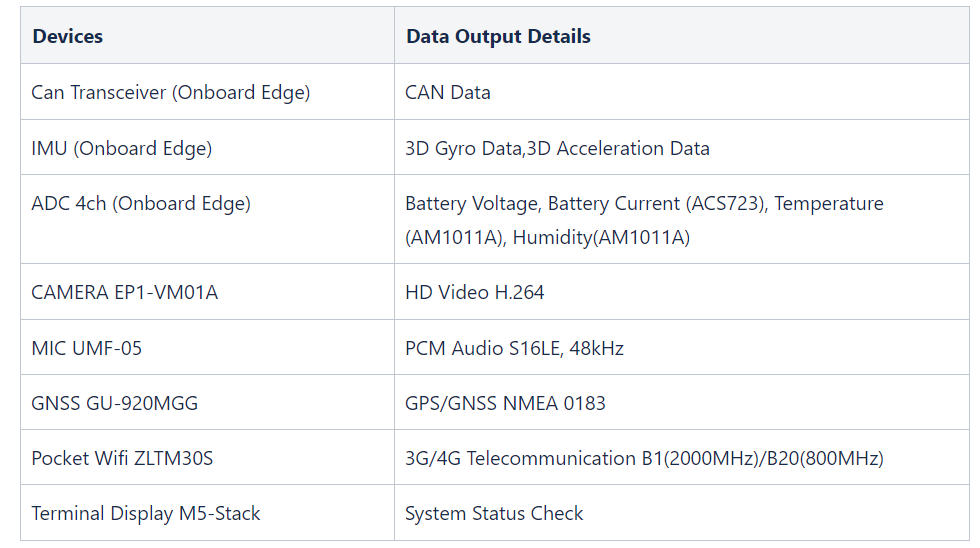
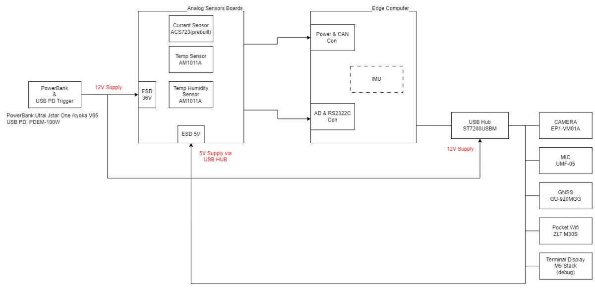
Here are the kind of data I would like to share: Video, Audio, CAN, GPS, Environment temperature and humidity, etc… Our hardware available to customers now is the EDGEPLANT T1. But for this trip, I decided to test our currently on-developing edge computer based on Raspberry Pi.
This edge is less powerful than the T1 but it is smaller, lighter, and easier to carry around. The hardware is enough to fit better our demand by providing an LTE module with a GPS incorporated, a 3D accelerometer and 3D gyrometer, 1 channel of CAN Bus, 4 entries for ADC, and 2 USB ports that could serve for the Video and Audio Data…
Telecommunication Restrictions Due to Radio Law Regulation
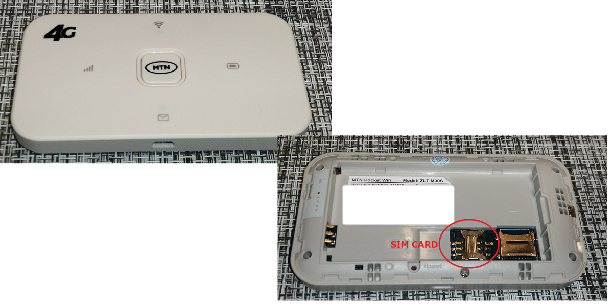
The first problem we encountered in our design was the Radio Law Regulation. Indeed, as in Japan where all products utilizing radio spectrum are to conform with the Japan Radio Law, we would need to use LTE modules and antennas to conform to the Radio Law and certificate our device with the ARTCI (Ivory Coast), the NCA(Ghana) and the ARCEP(Togo / Benin) to use a radio communication in these countries. Certification of a device can be costly and time-consuming. It is a necessity if we want to enter our product in a market. But in this kind of “one-time measurement”, we need a non-costly and easier way. We came up with the idea of using pocket Wi-Fi to connect to the network and get rid of the LTE module inside the edge.
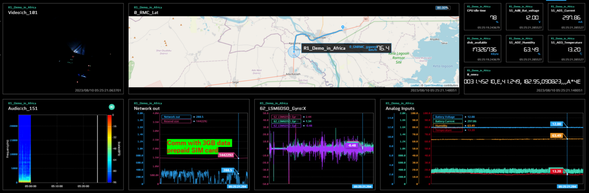
In Ivory Coast, we have two major Telecom companies, Orange and MTN (World Information and Communication Circumstances from Ministry of Internal Affairs and Communications). According to locals, Orange has the best rural coverage and helpful customer service while MTN is also available in Benin, Togo, and Ghana. We decided to use MTN to cover the trip inside Ivory Coast and the inter-regional one from Ivory Coast to Benin because we would be able to use the same pocket-wifi ZLT M30S (LTE up 50Mbps, CDMA 5.76Mbps). We just need to insert one 4G SIM from MTN to connect to the internet. Theoretically, we can also send out data by connecting our edge computer through the USB port of the pocket-wifi.
Devices Structure
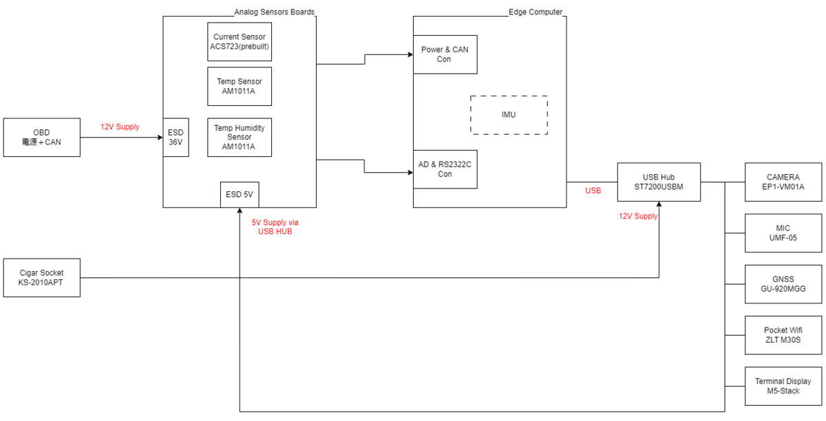
As we wrote above, the edge computer can handle an IMU (accelerometer and gyrometer), one CAN channel, 4 channels for ADC, and 2 USB ports. To connect to the ADC, we will use an analog sensor board where we measure the supplied voltage and the current in the edge, the temperature, and the humidity. For the USB ports, in addition to the camera and the microphone, we now have to handle also the USB-Wifi and the USB-GNSS. We therefore add a USB Hub ST7200USBM ( USB2.0 7 Ports) to connect the extra devices. The system looks now as follows.
Drive report of the trip
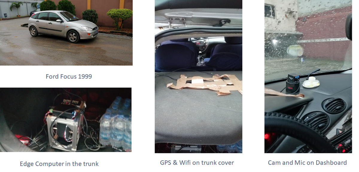
Drive around Abidjan Plateau

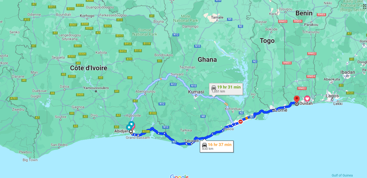
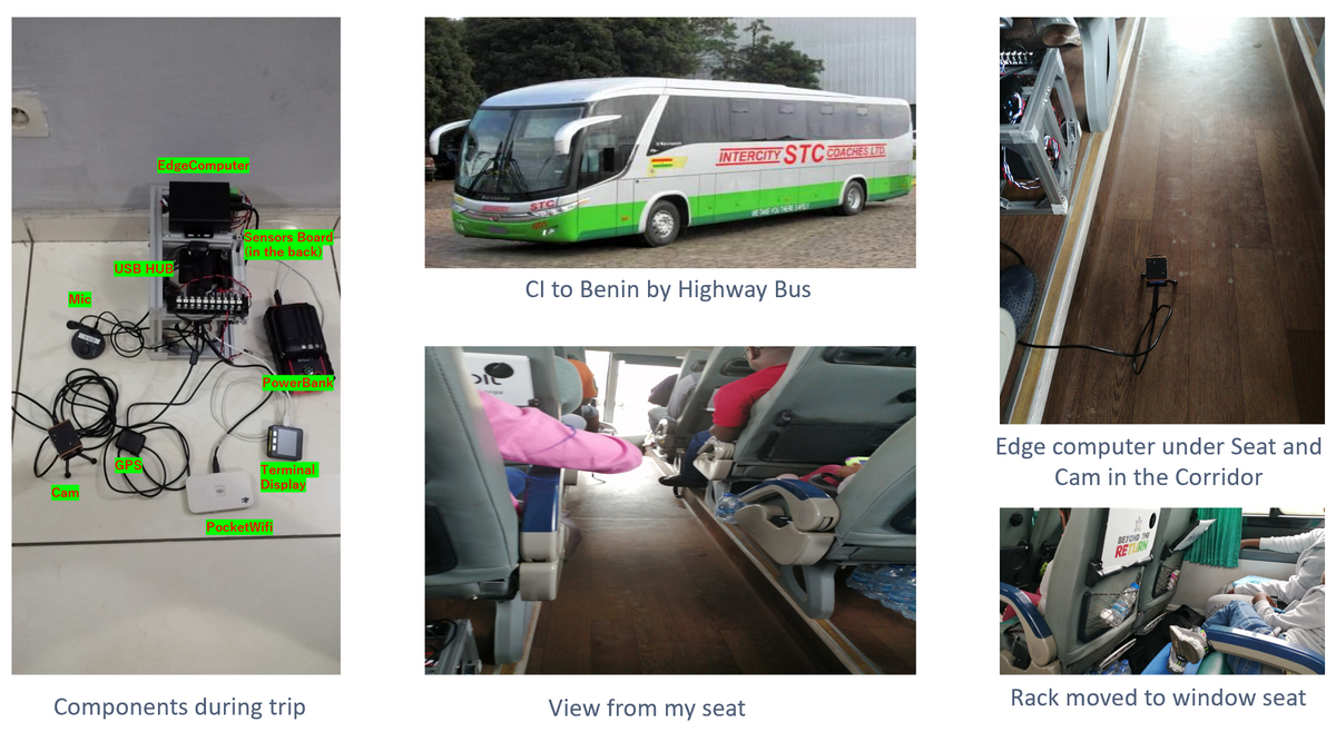
Trip Abidjan(CI) to Ouidah(Benin)
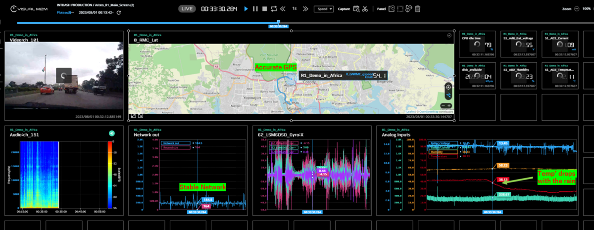
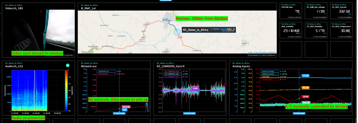
The system worked well and we were able to retrieve useful data from the different components. We were expecting to have network coverage all along the way from the capital to the Cote d'Ivoire/Ghana Frontier but lost the 3G connection around Aboisso (about 100km from the capital). Even after the loss of the connection, the data was recorded in the internal storage of the edge computer and later in Benin uploaded to the server.
One anecdote about the temperature in the bus. The temperature could not be regulated. So the drivers had to switch on/off the A/C manually periodically. If not, the temperature in the car can rise up to 40 degrees during stops when the doors are open or drop to 15 degrees at night. This explains the wavy form of the temperature data in our measurements.
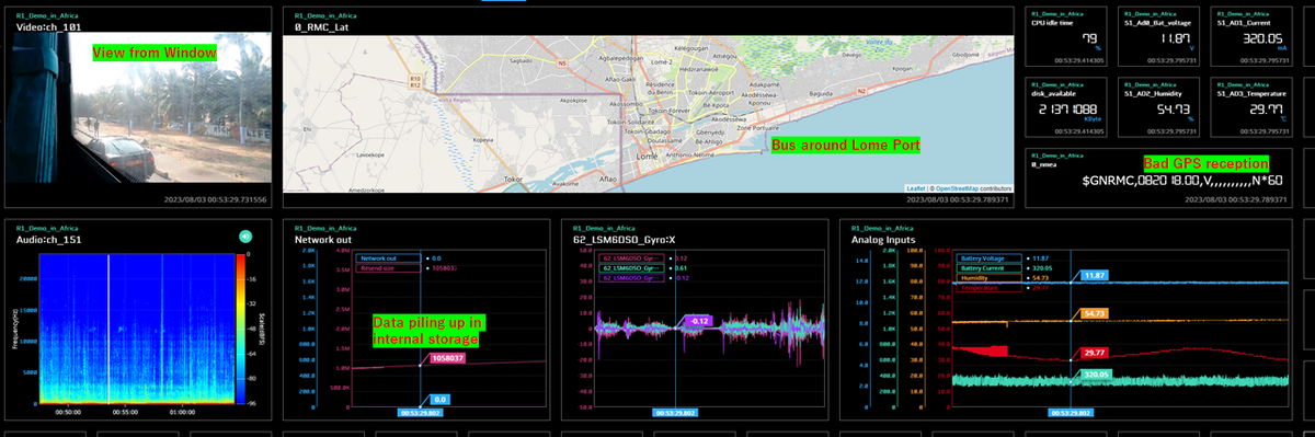
Trip Ouidah to Abidjan
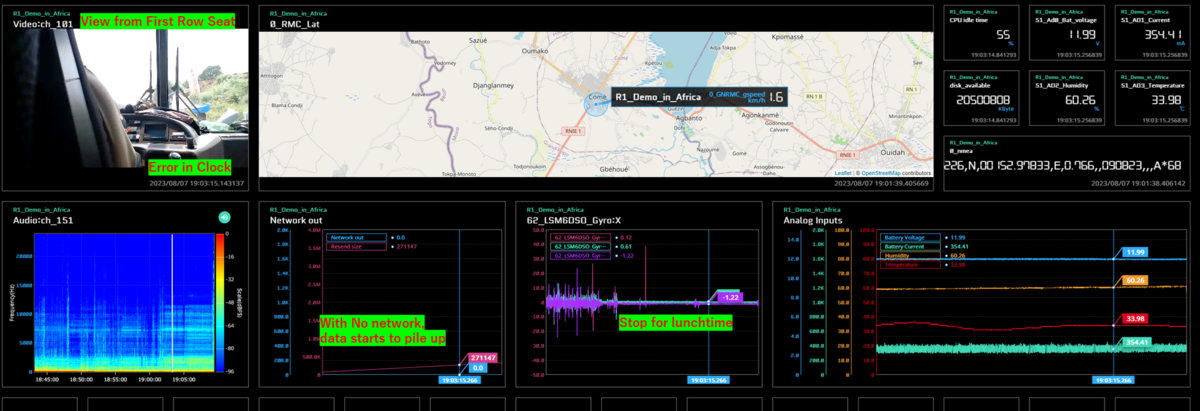
On the return trip, we used the same system as in the outbound journey. We found that a USB port was available under the seat so we were able to recharge our power bank and keep recording during the return trip. We were able to get the first-row seat of the car which gives us a better spot for the camera. On the other hand, since all the other passengers were passing by our seats during the stops, we had to keep all the other components inside the bag for safety. We end up losing sometimes the GPS signal and having the Audio signal filled with LTE noise. But the measurement in general was successful as we were able to retrieve more than 20 hours of detailed data.
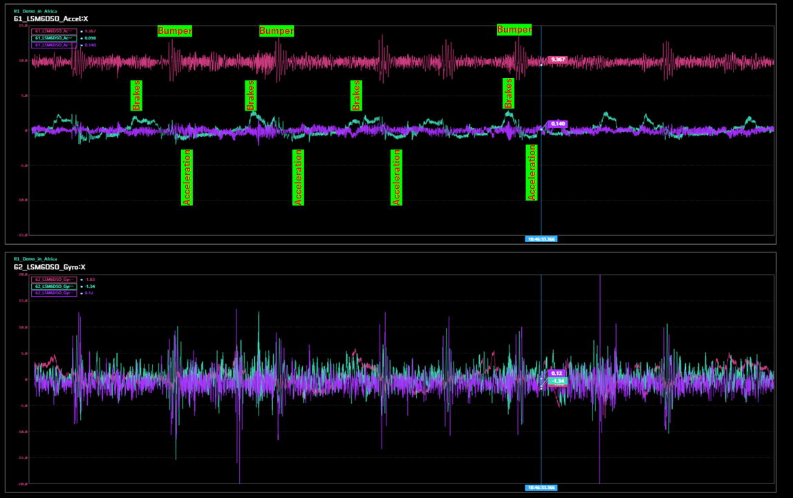
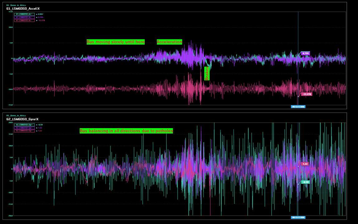
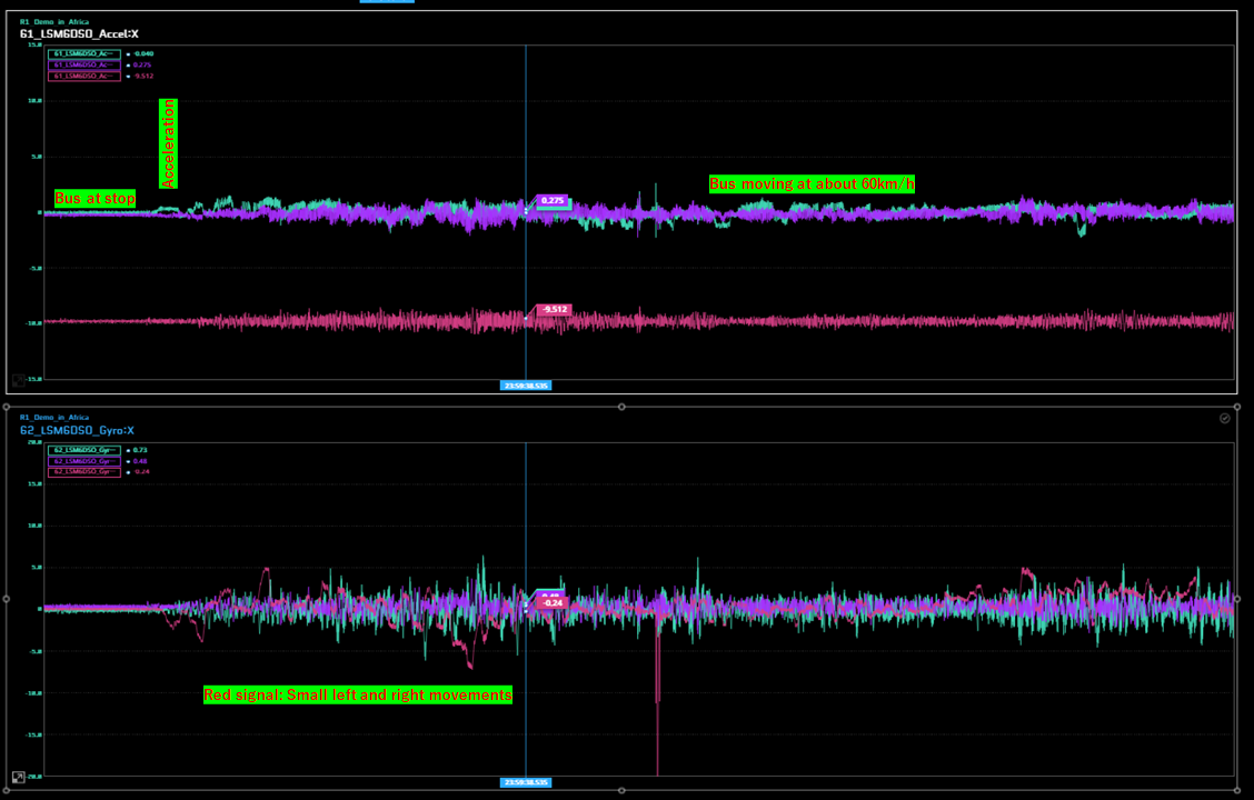
One interesting point of these data is that the IMU renders reliably the different road conditions, as we can see in the following pictures.
Introspection Points
For our overseas measurements, we were able to use the local networks and send even live data to Japan. The test was successful with very useful and detailed data from the GPS, ADC, and IMU. We still have some disappointments with the CAN BUS because we couldn’t retrieve CAN data from the vehicle we used in Abidjan. We still have to determine the exact causes but it looks like the 1999 year Ford was too old and had only the SAE J1850 PWM protocol. One another disappointment was with the Telecommunication environment. Around big cities like Abidjan and Accra, the network was stable and fast while in the countryside, it was almost slow or nonexistent. In these conditions, it was difficult to check and fix on-site data like the video or the audio channel. One discovery in this trip is that we could use the IMU and the GPS data to report in live time road conditions like barricades, bumpers, or potholes. We hope that this report will be useful to you when you use our system. Thanks for reading.